A series of maps below put in perspective the areas where the Armenian, Greek and Assyrian Genocides took place, the ancestral homeland of the Armenians, and the centres where relief for the survivors of the Armenian Genocide were established in the years following the genocide.
Armenian Genocide
Woodrow Wilson’s Armenia
Near East Relief
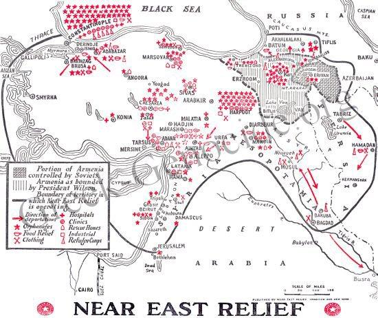
(A map drawn by the Near East Relief indicating the areas where Australian, American and other western aid reached survivors in the years immediately following the Armenian Genocide)
Assyrian Genocide
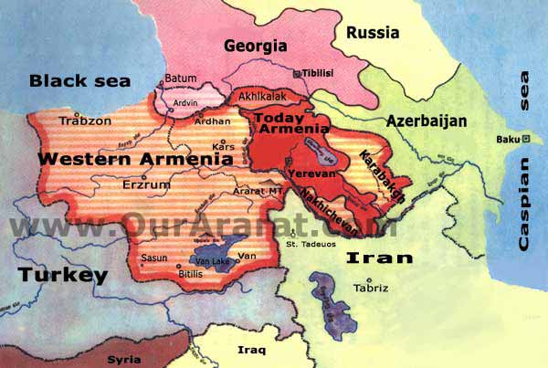
Greece, Turkey, Armenia, Syria, Iraq, Iran Map
Google Maps
(A present day map of Greece, Turkey, Armenia, Syria, Iraq and Iran - the areas where the Armenian, Greek and Assyrian Genocides took place during the early part of the 20th century)